
The new map of Hankley was surveyed in summer/autumn 1996 by Chris Morris and is being drawn by Robin Thomas on O-Cad at a scale of 1:15 000 for all courses. In the meantime here are parts of the 1991 map. (competitors who have the old map already have this advantage)
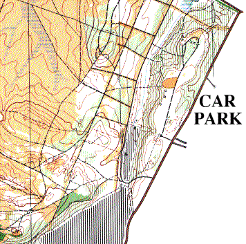
1991 Map of Hankley Common - SE Corner (73k GIF)
The car park is to the east of the road and will reached along the road shown from the NE. The start, finish and string course will all be on top of the ridge within about 200m of the entrance to the car-park.
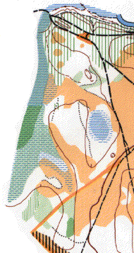
1991 Map of Hankley Common - NW Corner(37k GIF)
Alan Leakey (SLOW) has said that the leg north-south on this corner of the map is his favourite leg in the SE of England because it's the closest we get to Swedish terrain. Wander off slightly and you are in big trouble. Note the lack of paths east/west on this leg (this is a paths map).
Return to Main Menu