Mile End Park Race, 1st to 18th July
The fifth of our Summer Park Races takes us across to East London’s Mile End Park, courtesy of Rob Patterson. Once again, we have two courses for you to choose from, “Long” (around 5km direct line) and “Short” (around 2.5km). To count for the series results, you can do this race anytime between Thursday 1st and Sunday 18th of July.
Location
The race is best accessed from Mile End tube station on the Central, District and Hammersmith and City lines – 5min from Liverpool Street to the West and Stratford, to the East; it’s also a ten/fifteen minute ride along CS2 from the City of London.
The Start is just south of Mile End Road – if arriving by tube, turn left out of the exit and cross Burdett Road. The start is just before you reach the bridge over Mile End Road.
| Location | Mile End Park |
|---|---|
| Address | Burdett Road, Mile End |
| Latitude/longitude | 51.5249, -0.0351 |
| OS grid reference | TQ364824 |
| Maps | Google Maps, OpenStreetMap |
/-0.035080,51.524890,14,0,0/455x455@2x?access_token=pk.eyJ1Ijoib29icmllbiIsImEiOiJjaWwyb2d6M2MwMGM2d2dtNXI0Y2dobjdkIn0._yVvYZuMnUokZRhdRs0ysQ)
| |
The Race
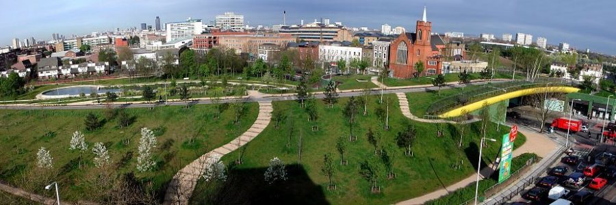
Mile End park is a busy East London park, divided into many different and interestingly landscaped sections. The canal path can be very busy, particularly in good weather, and pretty much all weekend in summer.
It’s very open and runnable – whilst I can’t guarantee you won’t encounter a nettle-sting, if you insist on seeking them out, shorts and short socks will be no impediment to your run.
Please obviously be considerate of other park users.
Mile End Road and Roman Road are out of bounds. Do not cross any roads – use the underpasses or bridges! The courses also take in a part of Queen Mary University campus – the gates are open to the public during the day – courses close at 8pm (the gates may be closed after then). There are lots of bits of temporary summertime structure (gazebos, temporary fencing etc) which are not mapped – they will not affect your route choice – ignore them!
The “special feature” symbol is used for benches. Other controls sites are located on sculptures (similar to the start).
Post run
The Palm Tree pub (you pass it in the second half of the courses) is doing takeaway drinks, if the weather is nice and you would like to remain in the park; there are many and varied restaurants around the Mile End tube stop.
Format
There will be two courses of 5.0km and 2.5km straight-line distance respectively. These are linear courses, which means you need to find the controls in order and the fastest person to do so wins.
As previously, we’ll be using the MapRun timing app, which also means that you can do the challenge anytime you like between Thursday 1st and Sunday 18th of July.
Technical details
If you haven’t already, please install MapRunF on your phone and download your selected course from UK > South London > ParkO > Mile End (Long or Short). If you’d like to run with a Garmin watch instead of your phone, follow these instructions as well.
Next, download and print the race map (you will need this to navigate). Here is the Long Map (corrected 6-Jul) and the Short Map. IOF symbol control descriptions are on the map and you can get a description of them here.
Note that (as usual), North is at the top of the map when printed and due to lack of space, the map has no legend but you can see an explanation of symbols here.
Once you’re ready to go, press ‘Go To Start’ (there is no code required) and the App or watch will start automatically when you’re at the start location. The App will record each control (beeping each time) and then stop your time when you’re at the finish.
Your result should be uploaded automatically, but you may need to ‘Get Track from Garmin’ if you’re using MapRunG.
All competitors take part at their own risk.
Enjoy the challenge! If you have any questions, just ask me on