MBO Information
Here’s some information to help in preparation for SLOW MBO orienteering events.
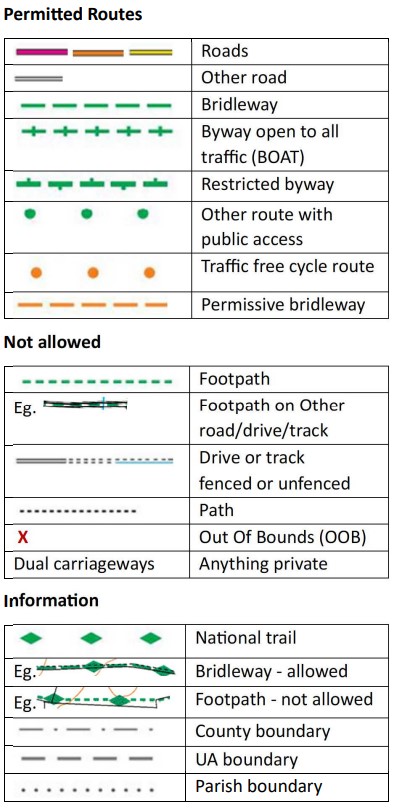
Map Symbols for Route Navigation
Key symbols from 1:25,000 Ordnance Survey maps:
MapRun – Getting Started
- Install the MapRun app for iOS or Android and complete your User Profile in the app.
- You do not need access to your phone while riding. It should work ok in your pocket or bag as long as you can hear the beep.
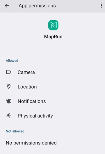
- Make sure you grant all requested permissions in full. During installation, if you’re not asked to grant any permissions you may need to find the App Permissions for the MapRun app and check them.
- Once you’re ready to ride, select “Go to start” and enter the 4 digit code which will be given out at the start. Once the GPS has activated the status bar at the bottom of the screen will change from red to green. The app will beep and your time will start immediately.
- Once started, do not exit the event.
- The finish will be activated once you have visited one checkpoint. At the finish the app will make a different sound (4 loud chimes). You’ll have 60 seconds to cancel it if you want to ride on to other check points. You may confirm that you’ve finished but it’s simpler to ignore the message and after 60 seconds the app will record your actual finish time.
- There is usually no need to use airplane mode unless your phone battery is very old.
- The GPS signal may be affected by tree cover so in some cases you may need to wait for a few moments for checkpoints to register.
To check location permissions on Android look in Apps & notifications and for Apple in Privacy > Location Services.
MapRun – Pre-event Checklist
- Ensure you’re running the latest version 7 of MapRun.
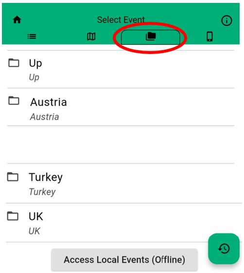
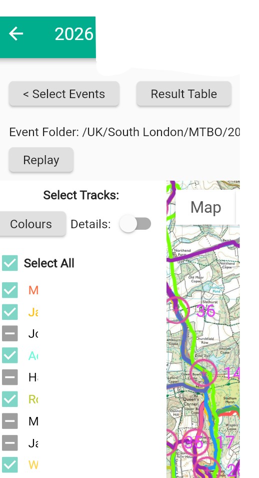
- Before arriving at an event load the correct course. Use the link in the pre-event email or, from the app, choose Select Event and navigate to UK / South London / MTBO. Ensure the app is showing MapRun folders (see screenshot below).
- Please ensure that First Name and Last Name/Surname match exactly in SiEntries.co.uk and your MapRun user profile. A mix of Bill/Will/William or names with and without accents etc. will fail to match your result.
- Check the Alert Sound is audible using the Test Punch option on the home screen. There are often multiple sound settings which are usually accessible from the volume button or your phone’s sound settings.
- Permission to raise notifications must be listed under “Allowed” as well the volume settings being turned up.
- It is recommended that you use a phone rather than a GPS watch unless you are very familiar with how to operate it. Synchronisation between your watch and phone can be very prone to errors when there a weak phone signal. GPS Watch Mode can be turned off in Options and Settings.
MapRun – Post-event Tips
- Make sure you’re online when you reach the finish.
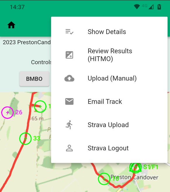
- Your results should upload automatically. If they haven’t done so, use Upload (Manual) from the menu on the results screen.
- Scores with BMBO penalties applied will be available from event Results in the app or the BMBO website.
- To claim missing checkpoints use Review Results (HITMO) “Hey, I think the GPS Missed One”. Please only try this once and if it doesn’t work then discuss with the organisers.
- You can view your own and other riders’ tracks from the MapRun Event Results screen. If your track is missing (Grey dash in screenshot below) use Upload (Manual), as above to refresh your results.
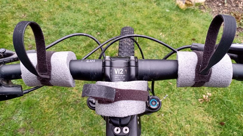
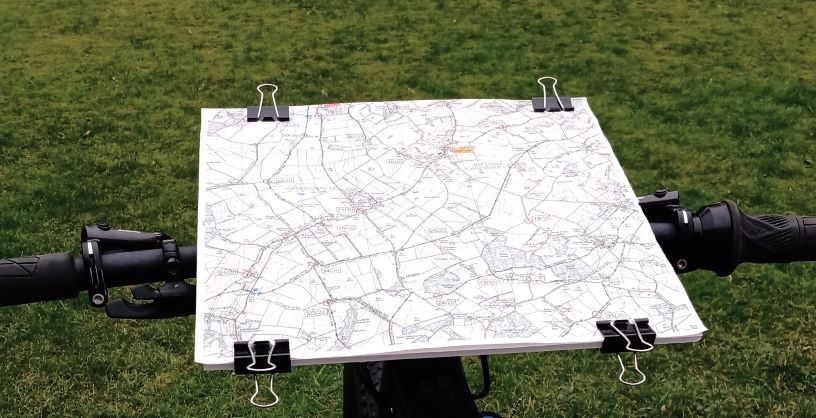
Map Boards
A board to hold the map on your handlebars is highly recommended. Whether this rotates or not is personal preference. There are numerous options available:
- Simple board using Foamboard, cardboard or Correx, held on with cable ties or velcro straps and bulldog clips. Pipe insulation to provide a sturdier base.
- Of the many specialist boards the Miry one can be bought in the UK from Facewest. The 12WR board size is recommended for A3 maps. The support frame is available for 31.8mm or 35mm bars. If you have (or may get) both sizes of bar the 35mm option fits very securely on 31.8mm bars with a couple of strips of inner tube.
- AutoPilot map holder for example PilotOne SH30 which can be ordered directly from the Czech Republic.