
Gunnersbury Park Race, 29 May to 15 June
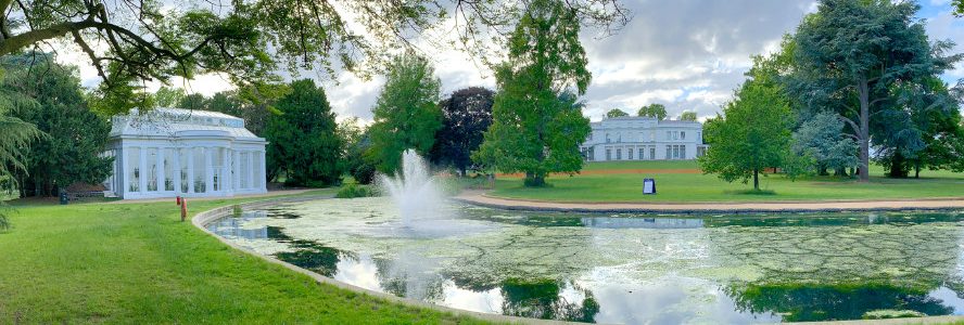
The third of our Summer Park Races takes us to a brand new map of Gunnersbury Park in West London, courtesy of Don McKerrow. Once again, we have two courses for you to choose from, “Long” (around 5km direct line) and “Short” (around 2.5km). To count for the series results, you can do this race anytime between 29th of May and 15th of June.
Don says: “The park is ideal for orienteering. It is very runnable but with plenty of complexity and more than large enough for a 5k course. It is amazing that it has never been used for orienteering before. The courses avoid the few parts of dense undergrowth so running in shorts would be fine. The courses are both traffic free apart from one route choice on the long course along the side of a car park.”
Please continue to respect the latest Coronavirus restrictions when taking part in this event, and please be courteous to other park users when out on your course.
Location
The start and finish are outside the Gunnersbury Park Sports Hub at dark.advice.shaky . It is 10 minutes walk from Acton Town tube and there is plenty of bike and (free) car parking right by the start.
There are toilets 4 minutes from the start just NW of Gunnersbury Park Museum at order.panel.grew . Round the south of the museum, at lied.hotels.year , is a kiosk selling snacks and refreshments until sunset.
| Location | Gunnersbury Park |
|---|---|
| Address | Gunnersbury Park Sports Hub |
| Latitude/longitude | 51.4986, -0.2911 |
| OS grid reference | TQ187791 |
| Maps | Google Maps, OpenStreetMap |
/-0.291060,51.498620,14,0,0/455x455@2x?access_token=pk.eyJ1Ijoib29icmllbiIsImEiOiJjaWwyb2d6M2MwMGM2d2dtNXI0Y2dobjdkIn0._yVvYZuMnUokZRhdRs0ysQ)
| |
Format
There will be two courses of 5.0km and 2.5km straight-line distance respectively. These are linear courses, which means you need to find the controls in order and the fastest person to do so wins.
As previously, we’ll be using the MapRunF timing app, which also means that you can do the challenge anytime you like between 29th of May and 15th of June.
Technical details
If you haven’t already, please install MapRunF on your phone and download your selected course from UK > South London > StreetO > Gunnersbury Park (Long or Short). If you’d like to run with a Garmin watch instead of your phone, follow these instructions as well.
Next, download and print the race map (you will need this to navigate). Here is the Long Map and the Short Map. IOF symbol control descriptions are on the map or you can download text ones here.
Note that (as usual), North is at the top of the map when printed and due to lack of space, the map has no legend but you can see an explanation of symbols here.
Once you’re ready to go, press ‘Go To Start’ (there is no code required) and the App or watch will start automatically when you’re at the start location. The App will record each control (beeping each time) and then stop your time when you’re at the finish.
Your result should be uploaded automatically, but you may need to ‘Get Track from Garmin’ if you’re using MapRunG.
All competitors take part at their own risk.
Enjoy the challenge! If you have any questions, just ask me on