
Hammersmith Street-O, Tuesday 10 May
Come along to the final street orienteering event of the 2021-2022 series. No more headtorches needed. Enjoy a lovely run in the daylight, finding checkpoints within an hour.
If you plan on coming, please fill in the Google Forms.
Reminder: You must return to the registration desk after your run to report that you are back. This is a safety check.
Race HQ
Our race HQ will be at The Black Lion, Hammersmith W6, situated on the northern banks of the Thames. You can leave your bags here (items left at your own risk).
The pub is easy to get to by public transport. conveniently linked by public transport. The closest tube station is Ravenscourt station, served by the District line, 12 minutes-walk away. Hammersmith station is 19 minutes-walk away connected by Piccadilly, District, Hammersmith and city and circle line. Local bus routes also available. Please check the TFL website before travelling.
The Black Lion has kindly agreed to let us use their venue. They also serve great food and drinks to accompany interesting post-race discussions. Should you have any queries, please send us an email on

| Location | Hammersmith |
|---|---|
| Address | Black Lion, 2 South Black Lion Lane, W6 9TJ |
| Latitude/longitude | 51.4903, -0.2417 |
| OS grid reference | TQ221782 |
| Maps | Google Maps, OpenStreetMap |
/-0.241735,51.490276,14,0,0/455x455@2x?access_token=pk.eyJ1Ijoib29icmllbiIsImEiOiJjaWwyb2d6M2MwMGM2d2dtNXI0Y2dobjdkIn0._yVvYZuMnUokZRhdRs0ysQ)
| |
what3words ///ticket.chew.second
Race Details
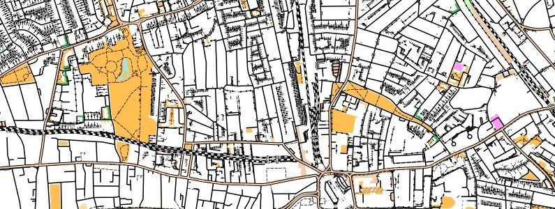
Entry fee is £2 for SLOW and LOK members, students and juniors and £4 for others. You will get a specially produced street map showing the control points you need to find.
If you’re not a SLOW member, please consider joining.
For the event, you’ll need to bring running gear and your phone with MapRun6 app installed (or Garmin watch with MapRun6 – MapRunG link set up). If using the app on your phone, a watch might be useful to keep within the time limit (so that you don’t have to keep checking your phone).
Like all our Street-Os, this a public race – all are welcome. You will need fill in the Google Form. Please aim to do this as early as possible (at least a week before the event if possible) so we can estimate the number of maps to print. You’ll just need to pay on the day.
| Registration | Between 1815 and 1915 |
|---|---|
| Start Times | Between 1815 and 1930 |
Format
We’ll be using the same ‘score’ format as previous years, where you have 60 minutes to collect as many points as possible. Using the map provided, find controls in whichever order you like, collecting 10 points for each control starting with a 1, 20 points for each starting with a 2 and so on. If you’re late, the penalty is 30-points per minute (or part minute) late. This guide provides general information about street orienteering.
1. If you haven’t already, please install MapRun6 on your phone.
Important note: We will be using MapRun6 for this event. If you have not done so already, please install MapRun6 / upgrade from MapRunF. Once installed, you need to enter a small amount of personal information – name and so on – to identify yourself in the results system. MapRun6 has enhanced responsiveness in getting an initial GPS fix and getting the best possible tracking throughout the run compared with MapRunF, and also has some new event set-up options for the organisers.
2. Download the race from Select Event > UK > South London > StreetO > Hammersmith May22. If you’d like to run with a Garmin watch instead of your phone, follow these instructions as well.
3. On the day at the start, the start official will give you the map, clue sheet and event PIN. Press ‘Go To Start’ in the app. When you are ready to start, enter the PIN. The instructions for running with a Garmin watch is slightly different and can be found in the link above.
4. Once the app starts the time, find controls in whichever order you like. Your phone should vibrate and beep each time.
5. Make sure you’re back within 60 minutes to avoid a 30-point penalty per minute (or part minute) late.
6. You must report back to the registration desk after you’ve finished, otherwise we’ll have to phone you or your emergency contact.
Important note: Do not run past the start/finish (at the pub) partway around your course (unless actually finishing), because the App will assume you’ve finished and stop your time.
Additional notes
The area has a lot of walls mapped on OpenStreetMap which then shows up on the orienteering map. The symbol for these walls is a black line with solid black circle. It will be impossible to remove all of these from the orienteering map so the map will look more cluttered than usual. Try to ignore these. Don’t confuse these for roads or paths!
All competitors take part at their own risk, and because of our insurance any under-16s must be accompanied by a parent or guardian.
If you have any questions, do ask them on the SLOW Facebook or email the organiser Himmy on